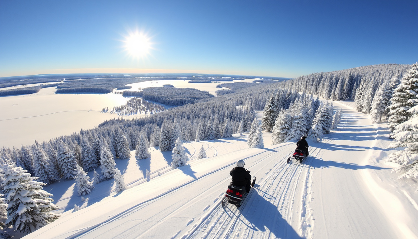

If you’re planning a snowmobile trip in Quebec, you’ve probably noticed that reliable trail maps aren’t always easy to find—let alone free ones. The good news is that the province’s official governing body, FCMQ, offers a free interactive trail map covering more than 30,000 km of federated trails across 13 regions. This guide walks you through exactly where to find it, what it shows, and how to use it for your 2025-2026 season ride.
Official Provider: FCMQ ·
Free Access Type: Interactive map ·
Compatible Devices: PC, Mac, Garmin GPS ·
Download Format: PDF ·
Regional Coverage: Quebec-wide including Gaspésie, Lac-Saint-Jean
Quick snapshot
- Quebec-wide trails with real-time sentier status updates (FCMQ Official Website)
- Free to access online with no plug-in required (Motoneiges.ca)
- Open/closed status visualization for randonnée planning (Pays de la Motoneige)
- Interactive viewer with real-time club-reported status updates (Pays de la Motoneige)
- Garmin-compatible downloadable trail files available at no cost for PC and Mac (Motoneiges.ca)
- Free download with no cost to rider (Motoneiges.ca)
- Lac-Saint-Jean map available as free download with print option (Saguenay–Lac-Saint-Jean Tourism)
- Mauricie region PDF sourced from FCMQ for 2025-26 season (FCMQ Official Website)
The following table consolidates the core facts about map availability and trail permits for Quebec snowmobile riders planning their 2025-2026 season.
| Key Fact | Detail |
|---|---|
| Primary Source | fcmq.qc.ca |
| Free Map Offered | Yes, interactive |
| GPS Compatibility | Garmin |
| Season Reference | 2025-26 |
| Regional Examples | Gaspésie, Lac-Saint-Jean |
Is there a free snowmobile trail map for 2026?
Yes — the FCMQ interactive trail map is available free of charge online for the 2025-2026 season. The federation collaborated with GéoProjection to build a browser-based tool that requires no special plug-in software to run. Unlike older versions that demanded separate downloads, riders can access the full Quebec snowmobile network directly through their web browser on any device.
FCMQ interactive options
- The map displays the entire 30,000 km trail network on Google Earth visualization (Motoneiges.ca)
- Topographical information is included, with clear boundaries for national parks, wildlife reserves, and Controlled Exploitation Areas (ZEC) (Motoneiges.ca)
- Distance calculations between trail points are simplified through the interface (Motoneiges.ca)
- Trail status is updated in real-time by FCMQ member clubs (Pays de la Motoneige)
Download availability
- PC and Mac users can download Garmin-compatible trail files at no cost (Motoneiges.ca)
- The iMotoneige mobile application provides offline access without requiring a data plan or cellular signal (FCMQ Official Website)
- Regional PDFs for areas like Lac-Saint-Jean and Mauricie are downloadable from tourism board websites (Saguenay–Lac-Saint-Jean Tourism)
The pattern shows that the mandatory trail permit—required by law for approved sentier access—costs substantially more than the map itself, making the free digital resource especially valuable for budget-conscious riders.
What is the price of the snowmobile trail map?
The interactive trail map itself costs nothing. What does carry a price tag is the mandatory trail permit required to legally ride on FCMQ-approvedsentiers. Trail permits must be purchased through the FCMQ official purchasing platform, and all fees include mandatory liability insurance under Article 19 of the Off-Highway Vehicles Act.
Standard pricing details
- Annual permit purchased October 1–31, 2025: $425 (FCMQ Official Website)
- Annual permit purchased November 1–December 15, 2025: $450 (FCMQ Official Website)
- Annual permit purchased after December 15, 2025: $550 (FCMQ Official Website)
- 7-day permit: $300 · 5-day permit: $240 · 3-day permit: $190 · 2-day permit: $150 · 1-day permit: $90 (FCMQ Official Website)
- Rental snowmobile annual permit: $650 · Antique snowmobile (2006 or older) annual permit: $325 (FCMQ Official Website)
Free alternatives
- Regional tourism boards like Saguenay–Lac-Saint-Jean offer free downloadable PDFs for their specific areas (Saguenay–Lac-Saint-Jean Tourism)
- The Pays de la Motoneige interactive viewer is free to access for trail status checking (Pays de la Motoneige)
Trail permits are non-transferable and non-refundable. Operating a snowmobile on approved trails without a paid permit is an offense under FCMQ regulations.
The implication is that riders who wait until the last minute pay a $125 premium over early-bird pricing—a strong incentive to purchase permits during the pre-sale window.
What is the FCMQ snowmobile trail map?
FCMQ (Fédération des clubs de motoneigistes du Québec) is the official governing body managing Quebec’s snowmobile trail network. Its interactive trail map is the primary digital planning tool for the province’s 13 regions, offering visualization of all federated sentier routes, real-time status updates, and topographical details without requiring users to download any special software.
Features and access
- The map runs entirely in-browser using Google Earth integration — open it on any device with internet access (Motoneiges.ca)
- Trail boundaries distinguish between national parks, wildlife reserves, and Controlled Exploitation Areas (ZEC) (Motoneiges.ca)
- Real-time sentier status (open/closed) comes from FCMQ member clubs reporting conditions (Pays de la Motoneige)
- Distance calculation between any two trail points is simplified through the interface (Motoneiges.ca)
Sentier types defined
- FCMQ organizes trails across 13 regions spanning Quebec’s snowmobile network (FCMQ Official Website)
- The map identifies boundaries of protected areas including national parks and wildlife reserves (Motoneiges.ca)
- ZEC (Controlled Exploitation Areas) boundaries are clearly marked to help riders avoid restricted zones (Motoneiges.ca)
The FCMQ map’s higher accuracy compared to previous versions means riders spend less time navigating around closed trails or restricted zones — a meaningful improvement for those planning multi-day routes through remote regions.
Snowmobile trail map for Gaspésie?
Gaspésie is one of Quebec’s most popular snowmobile destinations, and riders can access trail information through the FCMQ interactive map by selecting the regional view for that area. The FCMQ network covers Gaspésie trails, and real-time status updates reflect current trail conditions reported by local clubs.
Regional specifics
- Select region 12 (Gaspésie–Îles-de-la-Madeleine) within the FCMQ interactive map to view local sentier networks (FCMQ Official Website)
- Real-time open/closed status is reported by FCMQ member clubs in the Gaspésie area (Pays de la Motoneige)
- The map displays topographical details important for mountain trail navigation in the Gaspé Peninsula (Motoneiges.ca)
Free downloads
- The FCMQ interactive map is the primary free resource — accessible through any web browser with no download required (FCMQ Official Website)
- The iMotoneige app works offline for Gaspésie trails when cellular signal is unavailable (FCMQ Official Website)
Riders who skip downloading the offline app before reaching Gaspésie risk losing navigation access in dead zones where the FCMQ network remains the only reliable trail information source.
Snowmobile trail map for Lac-Saint-Jean?
Lac-Saint-Jean riders have access to both the provincial FCMQ map and a dedicated regional free PDF download through the Saguenay–Lac-Saint-Jean tourism board. The regional resource provides detailed local trail information with a print-friendly format, making it a practical backup when mobile signal is unreliable.
Saguenay-Lac-Saint-Jean map
- The Saguenay–Lac-Saint-Jean tourism board offers a free downloadable PDF map covering regional sentiers (Saguenay–Lac-Saint-Jean Tourism)
- The regional PDF includes print-optimized layout for riders who prefer a physical copy (Saguenay–Lac-Saint-Jean Tourism)
- FCMQ’s interactive map also covers the Saguenay–Lac-Saint-Jean region with real-time status updates (FCMQ Official Website)
Free ordering
- The regional PDF is available for direct download from the tourism board website with no cost or registration required (Saguenay–Lac-Saint-Jean Tourism)
- iMotoneige app users can access Lac-Saint-Jean trail maps offline without cellular signal (FCMQ Official Website)
The regional PDF may not reflect real-time trail closures as quickly as the FCMQ interactive map — riders should verify current status before heading out, especially early or late in the season.
Riders relying solely on the regional PDF risk encountering freshly closed trails that have yet to be updated in static documentation—a gap the FCMQ interactive map’s real-time updates directly addresses.
How to access and use the free snowmobile trail maps
Getting set up with the free trail mapping resources takes less than five minutes. Here’s the practical path from finding the map to loading it on your GPS or phone for offline use on the trail.
- Visit the FCMQ interactive map — Open fcmq.qc.ca and navigate to the interactive trail map section. No login or account creation is required.
- Select your region — Use the regional filter to focus on your intended riding area. The map displays all 13 regions; click or tap to isolate the specific area like Gaspésie or Lac-Saint-Jean.
- Check real-time trail status — Look for open/closed indicators on each sentier. Status data comes from FCMQ member clubs reporting current conditions — refresh the page for the latest updates.
- Download for offline use — For Garmin GPS users, download the compatible trail files through the SCDI mapping resource. Install the files following your device’s standard map loading procedure.
- Load the iMotoneige app — Download iMotoneige from the FCMQ website for offline access. The app requires no cellular signal or data plan to display trail maps — ideal for remote Quebec regions.
- Print a regional backup — For Lac-Saint-Jean, Mauricie, or other areas with regional PDFs, download and print a copy to keep in your sled’s storage compartment as a backup.
Trail status changes frequently — a sentier open this morning may close by afternoon due to weather or maintenance. Check the interactive map the morning of your ride, not the night before.
Confirmed facts
- FCMQ interactive trail map is free and accessible online with no plug-in required
- The 30,000 km federated trail network spans 13 regions across Quebec
- Regional sites like Saguenay–Lac-Saint-Jean offer free downloadable PDFs
- iMotoneige app provides offline access without cellular signal or data plan
- Trail permits are mandatory for riding on approved sentiers
What’s unclear
- Exact 2026-specific map update release dates
- Whether regional tourism boards outside Lac-Saint-Jean offer comparable free PDFs
- Future enhancement plans for the FCMQ interactive mapping platform
The new map, which unlike the previous version does not require the download of a special plug-in, contains a much higher degree of accuracy.
— FCMQ and GéoProjection (Motoneiges.ca)
Trail permits can only be purchased online, regardless of category. The FCMQ’s purchasing platform is the only official point of sale for trail permits.
— FCMQ (FCMQ Official Website)
Related reading: Houses for Sale St Colomban: Quebec & France Listings
fcmq.qc.ca, fcmq.qc.ca, fcmq.qc.ca, tourismemauricie.com, fcmq.qc.ca, tourismecentreduquebec.com
Frequently asked questions
How do I use the FCMQ interactive snowmobile trail map?
Visit fcmq.qc.ca, navigate to the interactive map section, and select your desired region. The map runs in-browser using Google Earth — no download or account required. Use the open/closed status indicators to plan your route and the distance calculation tool to estimate travel time.
Are snowmobile trail maps updated for 2026?
The FCMQ interactive map covers the 2025-2026 season with trail status updated in real-time by member clubs. Real-time status reflects current conditions rather than a static seasonal snapshot.
What devices support free snowmobile trail maps?
The FCMQ interactive map works on any device with a web browser — PC, Mac, tablet, or smartphone. Garmin GPS users can download compatible trail files. The iMotoneige app supports mobile devices for offline access without cellular signal.
Can I print the snowmobile trail map for free?
The FCMQ interactive map is not optimized for printing, but regional tourism boards like Saguenay–Lac-Saint-Jean offer free downloadable PDFs designed for printing. The Mauricie region also publishes a print-friendly PDF sourced from FCMQ for the 2025-26 season.
What sentier types are shown on the maps?
FCMQ’s map identifies boundaries for national parks, wildlife reserves, and Controlled Exploitation Areas (ZEC). Riders should understand that riding in protected areas without authorization is prohibited — the map helps distinguish restricted zones from open sentier routes.
How to plan a snowmobile trip using these maps?
Start by checking real-time sentier status on the FCMQ interactive map for your target region. Select your trail route and use the distance calculation tool to estimate travel time. Download the iMotoneige app for offline access during your ride. For Lac-Saint-Jean or Mauricie, also download the regional PDF as a physical backup. Remember to purchase your trail permit through the FCMQ platform before arriving at the trailhead.
Are there mobile apps for snowmobile trail maps?
Yes — the iMotoneige mobile application provides offline access to Quebec trail maps without requiring a data plan or cellular signal. Download it from the FCMQ website before your trip. The app displays the trail network even in remote areas where mobile coverage is unavailable.
For Quebec snowmobile riders, the free trail mapping resources are comprehensive and accessible without spending a cent on software. The FCMQ interactive map handles most planning needs, while regional PDFs and the iMotoneige app fill gaps for riders heading into areas with limited connectivity. The one cost that cannot be avoided is the mandatory trail permit — but at least you’ll know exactly where to find it and how to load the map before you buy.
Related stories


Jessica Morin covers provincial policy, regional economics and public affairs across Canada.